Accession#:
2003A-107
Date:
1965
Title:
Bolinas- Stinson Beach Master Plan Circa 1965
Area / Region:
Proposed Pt. Reyes National Seashore to Lone Tree Creek, Bolinas and Stinson Bea
Pubication Date:
Circa 1965
Language of Material:
English
Size:
18 1/2" x 24"
Medium:
Paper
Scale:
1" = 2000'
Location of Originals:
Library Map Drawer
Related Units of Description:
2005A-106 in color.
Catalog Date:
07/30/2004
Collection:
SBHS Map Collection
Dates of Creation:
1965
Map Language:
English
Scope & Content:
Map showing the master plan from Bolinas to Stinson Beach, including zoning and elevation.
Search Terms:
1965
Bolinas
Stinson Beach
Zoning
Ridgecrest Boulevard
Shoreline Highway
Panoramic Hwy
Mesa Road
Ocean Parkway
Trails
Duxbury Reef
Gull Rock
Stinson Beach State Park
Maps
Bolinas
Stinson Beach
Zoning
Ridgecrest Boulevard
Shoreline Highway
Panoramic Hwy
Mesa Road
Ocean Parkway
Trails
Duxbury Reef
Gull Rock
Stinson Beach State Park
Maps
Click to Enlarge
 Bolinas-Stinson Beach Master P
 Bolinas Stinson Master Plan 19
 Bolinas-Stinson Beach Master P
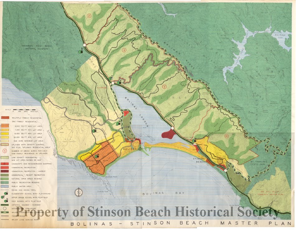 Bolinas Stinson Master Plan 19