Table of Contents
Maps :
- Map
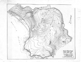
- 1993-688-01
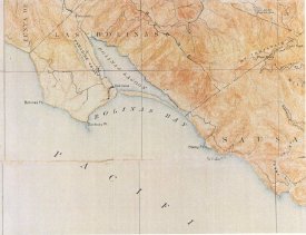
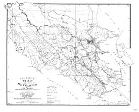
- Map of Mt. Tamalpais
- A color photographic print of a US Geological survey, California,Tamalpais Sheet, edition of 1897 (May), reprinted May 1907. Shows the portion encompassing the peak of Mt. Tam, Rocky Pt., Bolinas Bay, Bolinas town, Bolinas Point, The Pacific. It is t... View Full Record
- Map
- 1993A-100-01
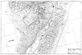
- SB Flood Drainage Mitigation Study
- Topographic Map of SB Flood Drainage Mitigation Study. First of 5 maps starting from the west.
... View Full Record

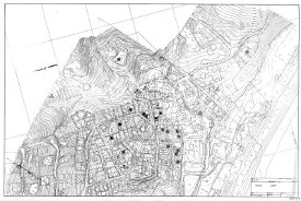
- Map
- 1993A-100-03, 04, 05
- SB Flood Drainage Mitigation Study
- Patios to Downtown Stinson Beach... View Full Record
- Map
- 1993A-101
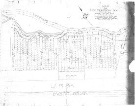
- Original Charles Robinson Tract
- Map showing subdivision of blocks 3 and 4 of Charles Robinson Tract... View Full Record

- print,photographic
- 1994-407
- Map Throckmorton Ranch
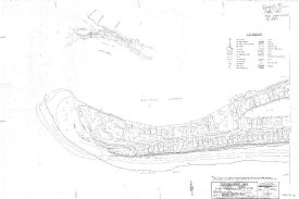
- A photographic copy of a map of Throckmorton Ranch, Tam Land and Water Company, located on Bolinas-Sausalito County Road, known as "Outside Road" to locals. The ranch appears to be located between the Rocky Point and the south end of Stinson Beach al... View Full Record
- Map
- 1994A-100
- Tourist's Map of Mt. Tamalpais
- Map showing Marin County Line to Nicasio... View Full Record
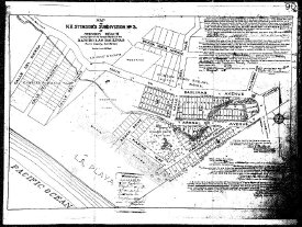
- Map
- 1994A-101
- N. H. Stinson's Subdivision No. 3
- Map of Stinson Beach from Calle del Sierra to Willow Street... View Full Record

- Map
- 1994A-102-01
- Bolinas Quadrangle U. S. Geogogical Survey
- Map showing Bolinas, Stinson Beach, Bolinas Bay, Bolinas Lagoon, and San Andreas Rift.... View Full Record
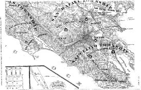
- Map
- 1994A-103
- Saucelito and San Rafael Townships School District Map 1873
- Map showing school districts in 1873 Marin County, railway lines, and land holdings of various people.... View Full Record

- Map
- 1994A-104-01
-
- Road and Trail Map of Mt. Tamalpais and Vicinity published in 1908. It shows trails in dotted line and roads in double line, streams in dotts/line. Also shows telephones, camp sites, and convenience stations. Scale is 1 7/16 " = 2 miles. The highest... View Full Record

- Map
- 1994A-105
- N. H. Stinson's Subdivision No. 2 and No. 3
- Map of hill district and downtown... View Full Record
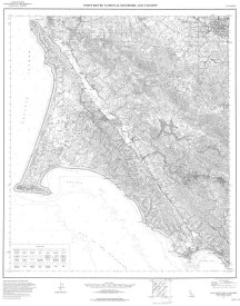
- Map
- 1994A-107
- Point Reyes National Seashore and Vicinity, Calif.
- Point Reyes National Seashore from Tomales Bay on the north to Stinson Beach on the south.... View Full Record
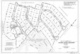
- Map
- 2002A-100
- Stinson Beach Highlands Subdivision Map 1945
- Stinson Beach Highlands Subdivision Map 1945... View Full Record

-
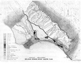
- 2003A-107
- Bolinas- Stinson Beach Master Plan Circa 1965
- Map showing the master plan from Bolinas to Stinson Beach, including zoning and elevation.... View Full Record
- Map
- 2003A-108-01
- Hiking Riding Trail Head
- From Stinson Beach to Kirby Cove... View Full Record
- Map
- 2003A-108-02
- Hiking Riding Trail Head
- From Olema to Stinson Beach... View Full Record

- Map
- 2003A-109
- Denny's Tourist Map of Mt. Tamalpais, Central and Southern Marin
- Denny's Tourist Map Of Mt. Tamalpias, Central and Southern Marin showing railways, wagon roads, trails, elevations, streams, and rancho lines.... View Full Record
- Map
- 2003A-110-01
- Rocky Point Tract (Steep Ravine Cabin Area)
- Rocky Point Tract Steep Ravine... View Full Record
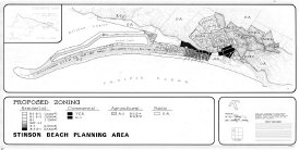
- Map
- 2003A-112
- SB Planning Area - Proposed Zoning
- Map showing Stinson Beach Planning and Proposed Zoning.
... View Full Record
- Map
- 2003A-113
- Bolinas/Stinson Master Plan Development, mid 60's
- Color map of Stinson Beach and Bolinas, Bolinas Lagoon, Bolinas Bay, Stinson Gluch to Copper Mine Gluch,Bolinas Meas and Baulines Ridge showing permitted development.... View Full Record
- Map
- 2003A-116
- Stinson Beach Map 55
- Parcel Map from Walla Vista, to Panoramic, to Highlands Subdivision... View Full Record
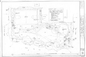
- Drawing, Architectural
- 2003A-117-02
- Stinson Beach Village Green Site Plan
- Village Green 1 Site Plan... View Full Record

- Drawing, Architectural
- 2003A-117-03
- Stinson Beach Village Green 1 Construction
- Village Green 1 Construction... View Full Record

- Drawing, Architectural
- 2003A-117-LI-2
- Stinson Beach Village Green Irrigation Detail
- Village Green 1 Irrigation Detail... View Full Record

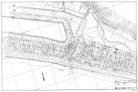
- Map
- 2003A-118-0
- Stinson Beach Base Map Master
- Subdivision Map of Stinson Beach... View Full Record

- Map
- 2003A-118-1-0
- Stinson Beach Base Map Tip of Seadrift
- Elevation map of the tip of Seadrift showing lots and houses... View Full Record

- Map
- 2003A-118-2-0
- Stinson Beach Base Map Seadrift
- Elevation Map of Seadrift showing lots and houses... View Full Record
- Map
- 2003A-118-3-0
- Stinson Beach Base Map End of Seadrift Begining of Patios
- Elevation map of end of Seadrift and begining of Patios... View Full Record
- Map
- 2003A-118-4-0
- Stinson Beach Base Map End of Patios and Calles
- Elevation map of Patios and Calles showing lots and houses.... View Full Record
- Map
- 2003A-118-5-0
- Stinson Beach Base Map Hill
- Elevation map of hill showing lots and houses... View Full Record
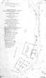
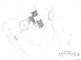
- Drawing, Architectural
- 2003A-119
- Stinson Beach Community Center Block 6
- Sinson Beach Community Center and Easkoot Creek... View Full Record
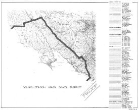
- Map
- 2003A-120-01
- Bolinas-Stinson Union School Boundaries
- Map of school district... View Full Record

- Drawing, Architectural
- 2003A-120-02
- Bolinas-Stinson Union School District Stinson Plan Study
- Stinson Plan Study... View Full Record
- Drawing, Architectural
- 2003A-120-03
- Bolinas-Stinson Union School Stinson Site Plan Study
- Stinson Site Plan... View Full Record
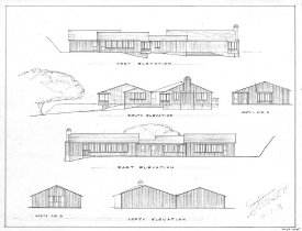
- Drawing, Architectural
- 2003A-120-04
- Bolinas-Stinson Union School District Sketch View S B Replacement
- Stinson Beach School Replacement... View Full Record
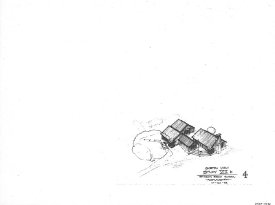
- Drawing, Architectural
- 2003A-120-05
- Bolinas-Stinson Union School District S B Sketch View
- Detail of 4 buildings of Stinson Beach School... View Full Record

- Drawing, Architectural
- 2003A-120-06
- Bolinas-Stinson Union School District S B Old Buildings
- Old Buildings of Stinson School... View Full Record

- Drawing, Architectural
- 2003A-120-07
- Bolinas-Stinson Union School District S B Old Building
- Old Buildings of S B School... View Full Record

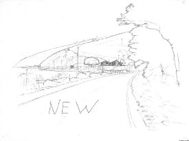
- Drawing, Architectural
- 2003A-120-08
- Bolinas-Stinson Union School District New S B School
- New Building Sketch... View Full Record
- Drawing, Architectural
- 2003A-120-09
- Stinson Beach School
- New Site... View Full Record

- Drawing, Architectural
- 2003A-122-01
- Irrigation Plan Of Village Green 1
- Irrigation plan for Village Green 1 showing materials used and manufacturers.... View Full Record

- Drawing, Architectural
- 2003A-122-02
- Irrigation Plan of Village Green 1
- ... View Full Record
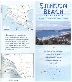
- Pamphlet
- 2003L-102-03
- Stinson Beach California Where the Mountain Meets the Sea
- ... View Full Record

- Map
- 2005A-102
- Marin County-Parks
- Marin County... View Full Record
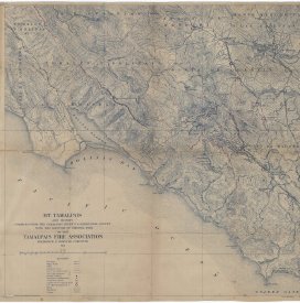
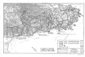
- Map
- 2007A-123-01
-
- A print of a map approx. 36" x 39" printed from an original and marked by red pencils. Completed from The Tamalpais Sheet US Geologic Survey with Addition of Original Data. By the Mt. Tamalpais Fire Association, Frederic E. Olmsted, Forester, dated 1... View Full Record
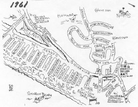
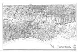
- Map
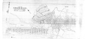
- 2010A-103
- Stinson Beach 1961
- A print of illustrated street map of Stinson Beach. The original was probably done in ink and shows street of Stinson Beach . It does not include Seadrift where hardly any houses were then. The map also shows then existed Seadrift Causeway. The libra... View Full Record

- Map
- 2011A-103
- Map of Marin County, California Completed by H. Austin from Official Surveys and (Illegible) Drawn by F. Whitney 1873
- Map of Marin County printed in brown ink and mounted on a card board. It identifies 8 townships exiting then within the Marin County boundary in 1873 and many school districts within the townships. It also shows individual land holders by names and t... View Full Record

- Map
- 2012A-101-01
- Map A
- Proposed Southern Entrance to Stinson Beach State Park named Map A was a page of book made to the public by the Stinson Beach Planning Group, predecessor of Stinson Beach Village Association. It proposes existed dirt service road to the Stinson Beach... View Full Record

- Map
- 2012A-101-02
- Map B Proposed Causeway for Stinson Beach Emergency Access
- Proposed Causeway for Stinson Beach Emergency Access named Map B was a page of book made to the public by the Stinson Beach Planning Group, predecessor of Stinson Beach Village Association. It proposes existed dirt service road to Seadrift from Shore... View Full Record
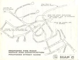
- Map
- 2012A-101-03
- Map C
- Proposed Fire Road Repair and Construction and Proposed Street Name named Map C was a page of book made to the public by the Stinson Beach Planning Group, predecessor of Stinson Beach Village Association. It proposes existed fire roads to Stinson Ran... View Full Record

- Map
- 2013A-103-01
- Map of Stinson Beach
- A Xerox copy of a hand drawn street map of Stinson Beach. It has a copyright sign with BLR initial dated 1987. It shows all the streets of Stinson Beach with the names including from the Fire Station to the east to Seadrift Rd and Dipsea Rd near the... View Full Record