Accession#:
2007A-123
Date:
1914
Area / Region:
Mt Tamalpais and Vicinity
Projection:
from Bolinas to Golden Gate, from San Rafael to Golden Gate
Publisher:
Mt Tamalpais Fire Association, Frederick E. Olmsted, Forester
Pubication Date:
1914
Size:
36x39
Medium:
Paper
Scale:
2.5 inches=1mile
Location of Originals:
Media Safe, SBHS Map 3 CD
North Latitude:
36.00
Catalog Date:
01/15/2008
Collection:
SBHS Archival Collection/Map Collection
Dates of Creation:
1914
East Longitude:
120.30
Map Language:
English
Scope & Content:
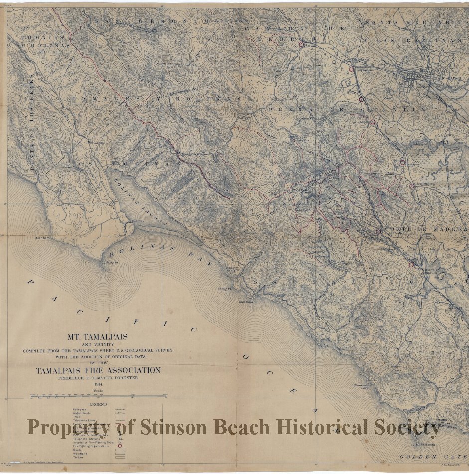
A print of a map approx. 36" x 39" printed from an original and marked by red pencils. Completed from The Tamalpais Sheet US Geologic Survey with Addition of Original Data. By the Mt. Tamalpais Fire Association, Frederic E. Olmsted, Forester, dated 1914. The Map includes area; N36degree oo' S to N37degree 45'S and W122degree 45'E to W122degree 30'E. The Legend includes: Rail Roads, Wagon Trails, Telephone Lines, Constructed and Proposed Fire Trails, Lookout Stations, Supplies of Fire Fighting Tools, Fire Fighting Organizations, Brush, Woodland, Timberland. It was framed in a wooden frame with glass.
Search Terms:
1914
Maps
Marin County
Mount Tamalpais
Mount Tamalpias Rail Road
Mt.Tamalpais
Fire Department
Mt. Tamalpais Vicinity
Telephone Lines
Maps
Marin County
Mount Tamalpais
Mount Tamalpias Rail Road
Mt.Tamalpais
Fire Department
Mt. Tamalpais Vicinity
Telephone Lines
West Longitude:
122.45
Click to Enlarge
 Mt. Tamalpais and Vicinity
 Mt. Tamalpais and Vicinity